Define Your Property with Precision
Request A Comprehensive Survey
Comprehensive Survey Services
At Campbell & Associates, Inc., we provide precise, reliable, and legally sound surveying solutions tailored to meet the needs of landowners, developers, engineers, and contractors. With a commitment to accuracy and efficiency, our team of experienced surveyors and drafters utilizes advanced technology and industry expertise to deliver high-quality results.
Whether you need a boundary survey for a residential lot, a topographic survey for a large-scale development, or precise construction staking, Campbell & Associates, Inc. is your trusted partner for professional land surveying services. See the list below
Get started today - See a complete list of services below
Call us for a quote. One of our team members will be happy to provide a "no obligation" preliminary quotation for your review.

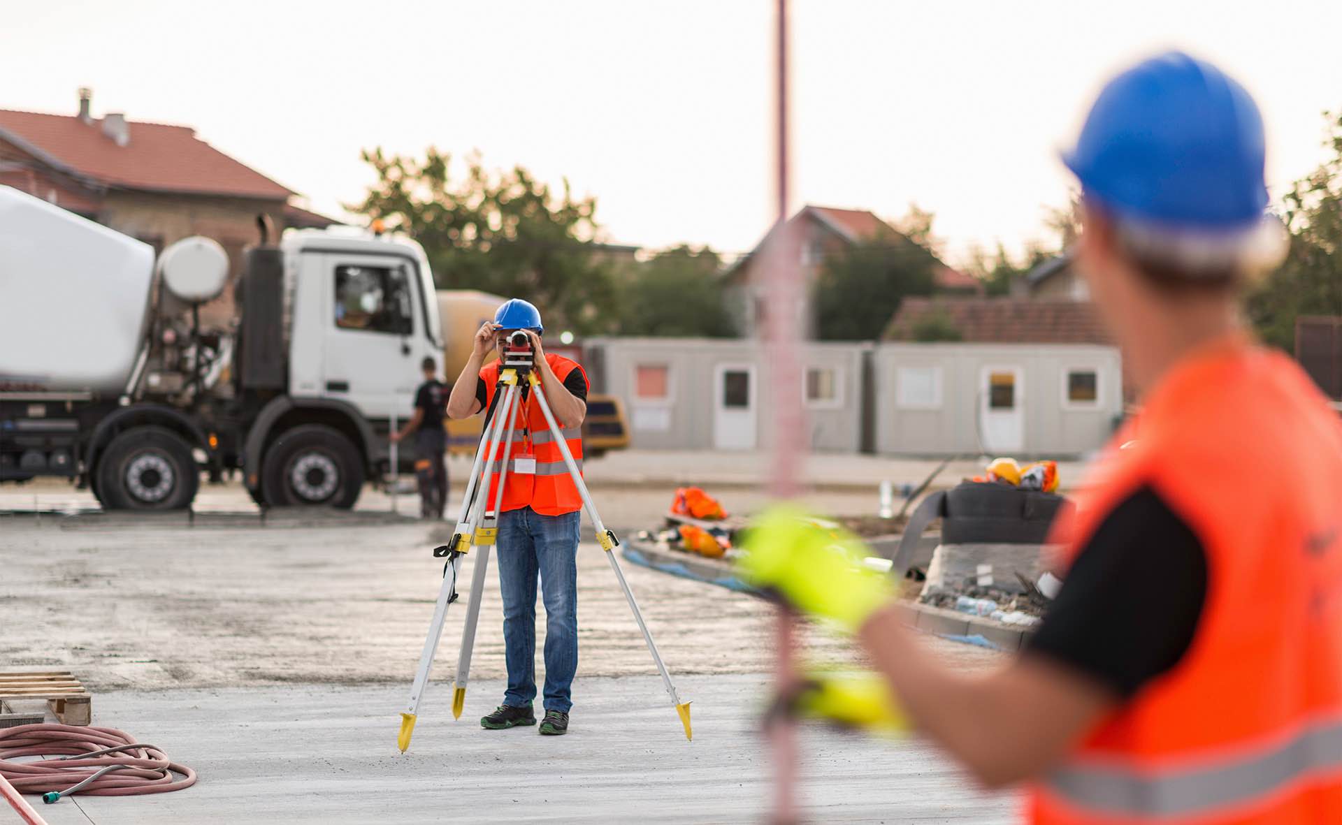
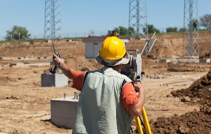
Surveying Capabilities
Boundary and Topographic Surveying
We offer a full range of professional land surveying services, including:
Establishing property lines with accuracy to prevent disputes and ensure legal compliance.
Preparing certified boundary plats and legal descriptions for property transactions.
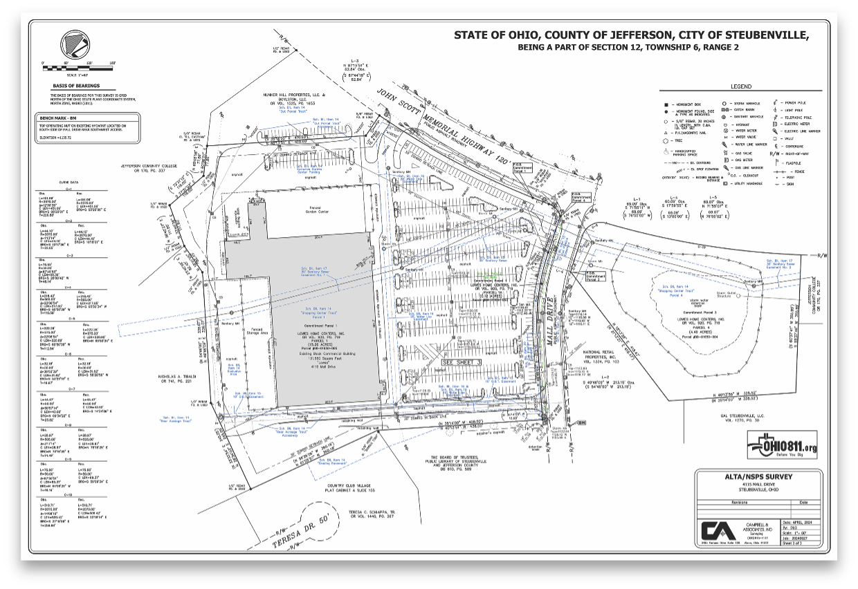
ALTA Land Title Surveys
Large Scale commercial ALTA surveys
ALTA Land Title Survey Standards compliant services
Subdivision & Land Development Surveys
Assisting developers with the subdivision process, including platting and zoning requirements.
Providing mapping and legal descriptions for new residential, commercial, and industrial developments.
GIS & Mapping Services
Creating detailed Geographic Information System (GIS) maps for municipalities, utilities, and private projects.
Integrating survey data into digital mapping platforms for easy accessibility and analysis.
Topographic & Site Surveys
Digital, measurable point cloud model
Aerial Data Services
Construction Staking & Layout
Capturing detailed elevation data for engineering, site development, and infrastructure projects.
Providing precise terrain mapping to support architectural and construction planning.
Floodplain & Elevation Certification
Preparing FEMA-compliant elevation certificates for flood insurance and property development.
Assisting property owners in determining flood risk and mitigation strategies.


Why Choose
Campbell & Associates?
Experienced Professionals
A team of licensed surveyors, drafters, and technicians with deep industry knowledge.
Cutting-Edge Technology
Utilizing the latest GPS, LiDAR, and drone surveying tools for maximum precision.
Regulatory Compliance
Ensuring every survey adheres to local, state, and federal standards.
Client-Focused Approach
Tailored solutions designed to meet the unique needs of your project.

Ready to get
to work?
Are you anticipating or currently ready to begin a new project? We encourage you to request a detailed land survey for your upcoming project to ensure accurate measurements and boundary determinations during construction. We encourage you to contact our office today!
Complete the form to contact us